




CV32
Staff Pukes
-
Joined
Everything posted by CV32
-
Ain't that the truth. Okay, then the answer to your original question is 'Yes'. Installation damage point (DP) values are capable of being edited in the database, so yes, we can change em. The question that arises, of course, is whether we should. Most VLarge airfields in the DB currently have DP values in the range of 7,500 to 9,000. (Compare that to the 52 DP value of a 2,000 lb Mk 84 iron bomb). Most would probably agree that 173 bombs of that size would have a pretty devastating effect on most any airfield, especially since the hit probability (pH) of those bombs already takes into account that every successful hit actually struck something of value (i.e. a runway, a taxiway or a parking apron, for example, instead of out in the greenbelt or the nearby golf course). As you know, there are a myriad of scenarios that have been written on the basis (if only indirectly) of a certain expectation of how much punishment a particular installation can take. If we were to significantly alter the DP value of the installations, then we might very well frustrate not only the intentions of that scenario author but also the efforts of a player who had expected his sortie(s) to inflict a certain amount of damage. So, I'm not saying it isn't possible, but I do wonder whether it is wise. If there are particular installations in the DB that you think are too fragile, please identify them and I will certainly take a look at it. (You should do so in the 'HCDB requests' thread (or the thread for other relevant DB) rather than here).
-
I know you're kidding , but I have to take the opportunity to lay some accolades at the altar of Tony. Harpoon Classic has come light years beyond what it used to be. Truth is, working with the code we have, this simulation really has no business being as good as it is. Just a day or so ago, the man tweaked the code so that we can now put standoff ASW missiles on aircraft (bring on the Longshot High Altitude ASW Weapons (HAAWC)! woohoo!) as well as making sensors work in loadouts (need to carry a radar pod on that aircraft?). Many thanks to our exalted programmer. I am not sure why they do that, JMS, but I have noticed it and it is obviously something that needs tweaking if possible. Can you be more specific? Giving damaged bases the ability to repair themselves is a wish list item (its certainly on my wish list).
-
File Name: Threshold (Part 1 of 5) File Submitter: CV32 File Submitted: 20 Oct 2009 File Updated: 9 Mar 2010 File Category: Middle East DB Used: HCDB-090726 Authors: Brad Leyte Battleset-Middle East: .scv - CDB - CDB Threshold (Part 1 of 5) A Harpoon Commander's Edition (HCE) scenario for the new Middle East Battleset and the official HCE database (HCDB). This scenario is designed for play by the BLUE side. In September 2007, Israel is widely believed to have carried out an air strike that destroyed a partly constructed nuclear reactor in eastern Syria. While much of what really happened remains speculation, the event echoed a previous strike carried out by Israel against Iraq in 1981, when it destroyed a reactor at Osirak. Moreover, it underlines once again that Israel is a nation that feels very much under threat, whether rightly or wrongly, and has shown a willingness to take such action as it feels necessary to defend itself. Continued supposition about whether Israel would carry out a similar strike against long time foe Iran, or if necessary (and it probably would be necessary, to achieve the desired result), a wider military offensive, is alive and well in 2009. This scenario is the first of what will be a multi part campaign examining the possible result of a single aimed pre-emptive strike, and the resulting ever widening conflagration. Click here to download this file
-
Threshold (Part 1 of 5) A Harpoon Commander's Edition (HCE) scenario for the new Middle East Battleset and the official HCE database (HCDB). This scenario is designed for play by the BLUE side. In September 2007, Israel is widely believed to have carried out an air strike that destroyed a partly constructed nuclear reactor in eastern Syria. While much of what really happened remains speculation, the event echoed a previous strike carried out by Israel against Iraq in 1981, when it destroyed a reactor at Osirak. Moreover, it underlines once again that Israel is a nation that feels very much under threat, whether rightly or wrongly, and has shown a willingness to take such action as it feels necessary to defend itself. Continued supposition about whether Israel would carry out a similar strike against long time foe Iran, or if necessary (and it probably would be necessary, to achieve the desired result), a wider military offensive, is alive and well in 2009. This scenario is the first of what will be a multi part campaign examining the possible result of a single aimed pre-emptive strike, and the resulting ever widening conflagration.
-
I just uploaded an updated version of this scenario, to fix something I had overlooked. Apologies to the four (4) persons who had already downloaded the file.
-
A new version of the HCDA database, the Harpoon Commander's Edition (HCE) 'Americas' Database (HCDA-091019), is now available. It is available in the Downloads section of this website. New additions (or overhauls of existing entries) include: Submarines: Scorpene SS - Brazil Enjoy!
-
File Name: Outside the Anglosphere File Submitter: CV32 File Submitted: 19 Oct 2009 File Updated: 19 Oct 2009 File Category: South Atlantic DB Used: HCDA-091019 Authors: Brad Leyte Battleset-South Atlantic: .sct - CDB - CDB Scenario Background: Outside the Anglosphere A Harpoon Commander's Edition (HCE) scenario for the South America battleset and the HCE Americas (HCDA) database. This scenario is designed for play by the BLUE side. Novelist Neal Stephenson is credited with coining the term Anglosphere, referring to a community of nations that share not only the English language, but a "cultural heritage of liberty under the rule of law, honoring democratic forms of government, capitalism, individualism, willing delay of gratification, and adhering to covenants and contracts regardless of clan or community ties". There are many nations outside the anglosphere, however, some of them found within the New World. In Latin America, politics have always been fluid and fragile, and the new roots of democracy, established within the last few decades, are especially delicate. Having finally put their economic houses in order, Brazil and Argentina embarked on a vast military modernization program, taking full advantage of the eagerness shown by France, Russia, and China to supply them with weapons and technology in exchange for access to their vast natural resources. This coincided with the emergence of new (though perhaps not unexpected) left wing governments which showed fervent dislike for the Anglosphere, and took every opportunity to point out the old scars of colonial exploitation. Argentina has now taken advantage of a large scale joint exercise with Brazil and France to once again seize the Malvinas (Falklands). Click here to download this file
-
Scenario Background: Outside the Anglosphere A Harpoon Commander's Edition (HCE) scenario for the South America battleset and the HCE Americas (HCDA) database. This scenario is designed for play by the BLUE side. Novelist Neal Stephenson is credited with coining the term Anglosphere, referring to a community of nations that share not only the English language, but a "cultural heritage of liberty under the rule of law, honoring democratic forms of government, capitalism, individualism, willing delay of gratification, and adhering to covenants and contracts regardless of clan or community ties". There are many nations outside the anglosphere, however, some of them found within the New World. In Latin America, politics have always been fluid and fragile, and the new roots of democracy, established within the last few decades, are especially delicate. Having finally put their economic houses in order, Brazil and Argentina embarked on a vast military modernization program, taking full advantage of the eagerness shown by France, Russia, and China to supply them with weapons and technology in exchange for access to their vast natural resources. This coincided with the emergence of new (though perhaps not unexpected) left wing governments which showed fervent dislike for the Anglosphere, and took every opportunity to point out the old scars of colonial exploitation. Argentina has now taken advantage of a large scale joint exercise with Brazil and France to once again seize the Malvinas (Falklands).
-
I understand, though you had also made the comment that this happens to you almost constantly. I'm simply saying that it almost never happens to me. Okay, so you understand formation zones and all that. Good. I think I stated earlier that when transiting narrow bodies of water, I try and shrink my own formations to their lowest common denominator. So, moving on ... Again, this has not been my experience. If we know that water depth is a function of distance from land, and the land certainly is readily determined from the map graphics, and we know that we can find out water depth at any particular point by clicking on the map at that point, then setting a course to avoid running aground is an achievable task. I recall the 'snap' behavior in laying courses that you mention, but since the zoom feature was considerably expanded many versions ago, I can't recall it being a problem anymore, except maybe at very high zoom. I have not seen the 'waypoints over land in the GE' issue you mention, though I suppose its possible if a person was laying courses at low zoom in areas of constricted waters. But then, why would anyone want to do that? There are some very small islands on the maps that do not show until you really zoom in. (Proximity to land aside). Otherwise, I am not aware of any 'shoals' on the maps. Can you point to a specific scenario or map location? I understand, and it seems my only reply is that beyond practise and experience, I don't know if there is anything available to help you. Okay.
-
File Name: Happy Time File Submitter: CV32 File Submitted: 19 Oct 2009 File Category: GIUK DB Used: HCWW-091016 Authors: Brad Leyte Battleset-GIUK: .scm - EC2003 - EC2003 Happy Time A Harpoon Commander's Edition (HCE) scenario for the EC2003 GIUK battleset and the HCE World Wars (HCWW) database. This scenario is designed for play by the RED side. Until France had fallen in June 1940, the range of the Kriegsmarine's U-boat force had been constrained by geography. They had to make a long and risky transit around Scapa Flow in order to reach the Atlantic shipping routes. The capture of French Atlantic ports, however, now meant that the U-boats could carry consistent attacks on the Allied convoys. Operating on the surface and guided by radio communications, groups of U-boats could form wolf packs, focusing their efforts to find and destroy Allied convoys and thereby starve Great Britain of badly needed supplies. Furthermore, by Autumn 1940, previous problems with faulty German torpedoes began to be rectified, and in addition, the Allies began concentrating their convoys into a route that took them through the North Channel between Ireland and Scotland. This target rich environment made for fertile hunting grounds for Admiral Donitz's U-boat fleet. This was their 'Happy Time'. Image credit: http://www.wreckhunter.net Click here to download this file
-
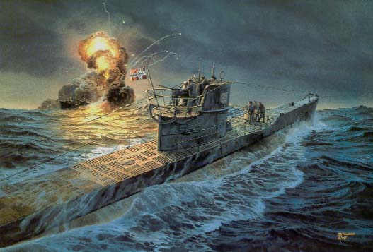 Happy Time A Harpoon Commander's Edition (HCE) scenario for the EC2003 GIUK battleset and the HCE World Wars (HCWW) database. This scenario is designed for play by the RED side. Until France had fallen in June 1940, the range of the Kriegsmarine's U-boat force had been constrained by geography. They had to make a long and risky transit around Scapa Flow in order to reach the Atlantic shipping routes. The capture of French Atlantic ports, however, now meant that the U-boats could carry consistent attacks on the Allied convoys. Operating on the surface and guided by radio communications, groups of U-boats could form wolf packs, focusing their efforts to find and destroy Allied convoys and thereby starve Great Britain of badly needed supplies. Furthermore, by Autumn 1940, previous problems with faulty German torpedoes began to be rectified, and in addition, the Allies began concentrating their convoys into a route that took them through the North Channel between Ireland and Scotland. This target rich environment made for fertile hunting grounds for Admiral Donitz's U-boat fleet. This was their 'Happy Time'. Image credit: http://www.wreckhunter.net
 -
Can't say I agree with that. I don't have a problem with formations. Single ship/sub formations are certainly easier. For more on why units in other formation zones behave the way they do, I suggest you read the Tactics 101: Naval Formations tutorial. In real life, water depths would be considerably more complex than they are represented here. Here, it is a very simple function of how far from land you are. A few clicks of a mouse can tell you what to expect from what part of the map. It doesn't get any simpler than that. So, I have to say that I don't really understand why you're having trouble and I'm not sure I could do anything to explain it to you any better. Harpoon Classic has been this way for 20 years now. Are you sure you're even playing the same game as the rest of us? No offense, but I'm honestly just as baffled, but not about the same thing.
-
Well, as I said earlier, courses near land are always something to watch for. Unless you need to transit through a strait or other narrow body of water, however, it usually isn't an issue in most scenarios. Also formations can cause trouble, because your units at the edge of the formation are going to be most likely to 'bump up' against land. I will 'shrink' my formation size to its smallest possible (i.e. main body 1 nm across) size before transiting through any area where I believe this to be a concern. But, otherwise, its just a matter of using the zoom features to find the most sensible course. There really isn't any 'trick' to it.
-
If you are aware of the limitations, the process is actually very easy. And the 'scenario analysis' tool still exists in the SE.
-
-
Achieved Total Victory at 4:09:42 to go, following a Buccaneer anti-ship strike. Love that ole Buccaneer! Lost a few more aircraft, A-7E Corsairs and Phantoms, in the raid but no other losses. Thanks again for the enjoyable scenario, Ralf.
-
I have never encountered such a beast ... ever.
-
It applies to both sides. Yep, not only possible, but ordinary.
-
Only the orders for USS Chicago, which is acting as escort for USS Tennessee in this scenario, references it being 'expendable'. You need to be reading your orders more closely, grasshopper. In any event, losing one submarine is going to cost you your commission. Losing two submarines is going to put you in a bad TV movie.
-
You'll simply have to be careful when plotting courses that take ships or submarines into shallow waters or close to land. Especially where there are formation of multiple ships or submarines are involved.
-
I expect your problem here was related to the fact that gunnery ranges are calculated from center to center of formations.
-
Nope, no relationship. I have a reputation for not 'holding hands' with the player, as far as my scenarios go.
-
Choice of appropriate loadout is entirely yours. Sometimes you will find a scenario author give directions as to what loadouts not to use, so as to impose some limitations on what you can do, but I think on the whole you will find it very rare for a scenario author to tell you what you must use. IIRC, the orders in Oubliette tell you that the P-3s are available for maritime reconnaissance. Whether that means hunting and killing submarines or surface ships, or just snooping about, is your call.
-
File Name: Judgment File Submitter: CV32 File Submitted: 16 Oct 2009 File Category: MEDC DB Used: HCWW-091016 Authors: Brad Leyte Battleset-MEDC: .sco - EC2003 - EC2003 Judgment A Harpoon Commander's Edition (HCE) scenario for the EC2003 Mediterranean battleset and the HCE World Wars (HCWW) database. This scenario is designed for play by the BLUE side. The true potential of naval aviation did not come to the fore until the night of 11-12 November 1940, at a place called Taranto in Italy. By mid 1940 the naval balance of power in the Mediterranean did not favor the Royal Navy. The Regia Marina (Italian Navy) had six battleships and more ships of every other class, excepting aircraft carriers. The Italians had, however, thus far proved unwilling to bring their considerable firepower to bear, preferring to advance the idea of a fleet in being, and had remained close to home waters at their main fleet base in Taranto. Before the Germans could arrive and shift the balance of power irretrievably in favor of the Axis, Churchill hoped to reduce the Italian threat. A longstanding plan for attacking the Italian fleet at Taranto was pulled off the shelf and dusted off. That plan was called Operation Judgment. Image credit: 'Raid on Taranto', by Anthony Saunders. Click here to download this file
-
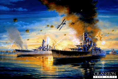 Judgment A Harpoon Commander's Edition (HCE) scenario for the EC2003 Mediterranean battleset and the HCE World Wars (HCWW) database. This scenario is designed for play by the BLUE side. The true potential of naval aviation did not come to the fore until the night of 11-12 November 1940, at a place called Taranto in Italy. By mid 1940 the naval balance of power in the Mediterranean did not favor the Royal Navy. The Regia Marina (Italian Navy) had six battleships and more ships of every other class, excepting aircraft carriers. The Italians had, however, thus far proved unwilling to bring their considerable firepower to bear, preferring to advance the idea of a fleet in being, and had remained close to home waters at their main fleet base in Taranto. Before the Germans could arrive and shift the balance of power irretrievably in favor of the Axis, Churchill hoped to reduce the Italian threat. A longstanding plan for attacking the Italian fleet at Taranto was pulled off the shelf and dusted off. That plan was called Operation Judgment. Image credit: 'Raid on Taranto', by Anthony Saunders.
